
A place in California
The district at a glance.
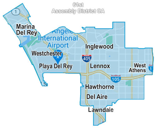
The AD61GOP map labels communities and landmarks across the district. It provides a visual starting point for exploring the area.
For address-level district information, use the official California State Assembly website and its Find My Rep tool.
Find official district information ↗- Marina del Rey
- Westchester
- Playa del Rey
- Inglewood
- Lennox
- West Athens
- Hawthorne
- Del Aire
- Lawndale
- Los Angeles International Airport
Places labeled on the existing website map; this is not an address-level boundary determination.
Our heritage collection
A place with a story.
Coastline scenes, aviation imagery, neighborhood life and local landmarks appear in the AD61GOP heritage collage.
